
Panorama Ridge Trail Summary
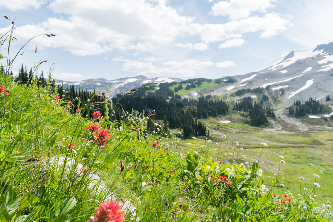
Situated between the towns of Whistler and Squamish, the Panorama Ridge trail is an incredibly unique hiking experience in Garibaldi Provincial Park. The trail to the top will take you through a dense forest of Douglass Fir and Western Red Cedar, through meadows covered in blooming wildflowers, and at the end will offer unbeatable panoramic views of Black Tusk and Garibaldi Lake that you do not want to miss. For those who have hiked around Vancouver extensively, the hike to Panorama Ridge remains one of their favorites.
As soon as you arrive at Panorama Ridge and take a glimpse of the extraordinary vantage point lying above Garibaldi Park, there’s no doubt that you will want to sit and take in the sights for as long as possible. The unbelievably blue waters of Garibaldi Lake are a stunning contrast against the white snow-capped peaks and dense green forest below.
Panorama Ridge has two main trailheads: Rubble Creek and Cheakamus Lake. Rubble Creek is known as the most popular trailhead since it is far more scenic, a bit shorter and gives room for the addition of the trail to the remarkable Tylor Meadows and Garibaldi Lake.
The path to Panorama Ridge, with Rubble Creek as the starting point, will take around 8-10 hours for the in and out hike, therefore making it a popular choice to stay overnight. The vast and unnatural looking mountain with its strange flat top that forms a table like a feature lies across the lake with the massive Mount Garibaldi not far away.
Looking back from there, you will see Black Tusk across the valley. With a similar elevation to Panorama Ridge, you get a magnificent view of its prominent features and you may even spot hikers climbing the peak. In fact, the Panorama Ridge viewpoint is the closest viewing platform to the iconic mountain.
Panorama Ridge Trail Information
The highest point of Panorama Ridge is 2,133 meters high and offers a breathtaking view of Black Tusk, Mt. Garibaldi, Mt. Price, and Garibaldi Lake among many other remarkable landmarks. If you are willing to push yourself or if you are in good shape, you can accomplish this hike within a day. However, the elevation gain and the distance to Panorama Ridge usually make for a very long day. Many opt to make it a multi-day hike and begin with fresh legs on day two from the camping area at Taylor Meadows or Garibaldi Lake.
The most popular route to Panorama Ride – Rubble Creek – offers a generous parking lot that is frequently filled with extra cars parked along the entrance. This is the only paved road to access Panorama Ridge. Even though it is often busy, this access point has been maintained to a high standard level. The trail is well marked and easy to follow, wide enough in some areas to allow side-by-side hiking.
Snow will linger on the peak well into the summer months which can make for a quick route down as you can slide down the snow when it is thick enough. The loose terrain at the top and along the ridge gets very exposed and steep in some parts so quality hiking boots are strongly recommended. The best hiking season is between June and October.
Hiking with dogs is not allowed in Garibaldi Park.

Panorama Ridge Hiking Route
The trail to Panorama Ridge starts from the Rubble Creek parking lot on the Garibaldi Lake. The first 6 km of the well-maintained trail is a gradual incline which has been created with a series of switchbacks. It is a sturdy, uphill ascent without relief from downhill or flat sections.
At approximately the 6 km mark, you’ll find yourself at a junction point with a fork for the Garibaldi Lake and Taylor Meadows campsites. Follow the sign to Taylor Meadows where the trail flattens out and becomes a lovely boardwalk through the fields.
As you make your way around Black Tusk Lake, you will begin a steep climb up the Panorama Ridge. Keep your eye out for glimpses of Mimulus Lake and Black Tusk Lake. You will also have an excellent perspective of Cinder Cone and Helm Lake from the East side of Black Tusk. There is no obvious path in this section. So, follow cautiously the cairns and whatever route you find to work your way up to the top of the ridge. Once you arrive at the peak you will immediately forget about your tired legs while enjoying the 360-degree view.
The unbeatable view will give you limitless options to frame your photos from on top of the ridge. After a well-deserved rest, to get back to the start it is just a matter of retracing your steps back to the Rubble Parking lot where you began.

We read this hike is 30km! The hikes in Garibaldi are all so big!
It’s a long one! Worth it though!
Did it a few years ago. Planning to go again this summer